Forums › Knowledge Base › Electronics › DC30 Track
- This topic has 23 replies, 9 voices, and was last updated 14 years, 11 months ago by
 greywolves.
-
AuthorPosts
-
2010-05-08 at 5:02 am #52574
 greywolves
Hi everyone,
Here is a veiw of the track from the opposite direction.
 2010-05-08 at 3:36 pm #52575SCOTT EVANS
My astro was set to record on default settings. Sean, If you have ever tracked with your astro there is prolly a track you can look at.
First trip out Asto recorded 756 points, takeing up only 17% in the “built in” memory storage.
So what is the smallest nose cone anyone has put a DC 20 into? was it a 38mm cirus dart? so many post
Thanks
I have one fit in a dart. Drilled a hole in the nose cone to recieve the antenna and still get in an altimeter. H and I shot. 8)
2010-07-16 at 11:53 pm #52576greywolves
Hey Guys,
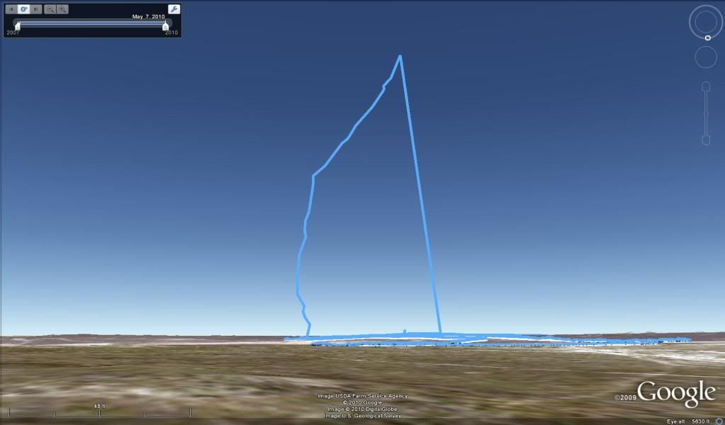
Here is a google earth comparsion, 2 tracks, lower track=7,401′. High track= 10,868′. Altitudes are from Raven, GPS on this last flight was 400 feet higher. Wish I could share some of the graphs from the Raven with you guys, they are Super Kool. I can’t seem to figure out how to export them. (Hint, Hint, Hi Adrian)
2010-07-17 at 2:10 am #52577Chris LaPanse
Very cool – is that from last weekend?
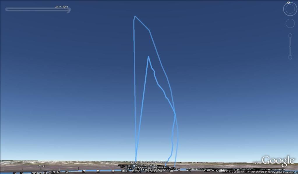
Here’s my track from my M1939 shot to 17,880 on Sunday morning – it gives a very good track of wind at all altitudes, since the descent rate was pretty much constant the whole way down (thanks to my dumping the main at apogee). It’s interesting to see how calm it was in the bottom 4000 feet or so, compared to the wind up high (oh, and the lower track was a flight by Richard and Kaleb Fonzi later in the day, on a longburn K motor).
2010-07-17 at 3:43 am #52578Warren B. MusselmanModeratorChris – you never gave me the data file you uploaded from my DC20 for my L3 (many thanks for your assistance by the way). I’ve been wondering what my flight looked like so would love to get the data file if you still have it.
Warren
2010-07-17 at 5:15 am #52579Chris LaPanse
Really? I’m sorry about that – I think I still have the file. I’ll check for it sometime this weekend, and get it to you if possible.
2010-07-17 at 5:23 am #52580greywolves
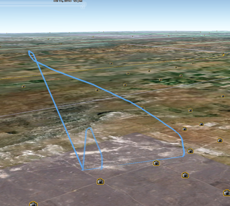
Awesome Chris, very nice looking, love the loop.
Yeah, from last weekend, highest track.
2010-07-19 at 3:44 pm #52581AdrianParticipantHey Guys,
Here is a google earth comparsion, 2 tracks, lower track=7,401′. High track= 10,868′. Altitudes are from Raven, GPS on this last flight was 400 feet higher. Wish I could share some of the graphs from the Raven with you guys, they are Super Kool. I can’t seem to figure out how to export them. (Hint, Hint, Hi Adrian)
In the Featherweight Interface Program, you can right-click in the plot window, and a button will pop up to copy the graph. (and by the way, if you right click in the parameter selection window, it will copy the data for pasting into Excel). From there, I paste into an image viewing program (IrfanView) and save as a .gif, then upload that to an image hosting service (photobucket)
2010-07-20 at 4:14 am #52582Chris LaPanse
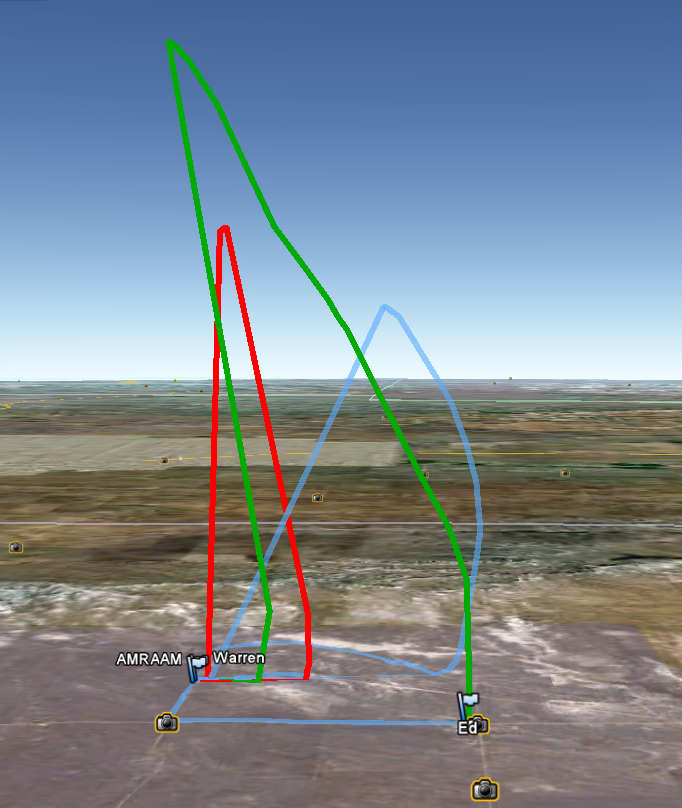
Warren: Here’s my GPS data from last Octoberfest. The blue track is yours, the red track is mine, and the green track is Ed’s. I also sent you the actual GPS file.
2011-05-09 at 4:20 am #52583greywolves
Hey guys,
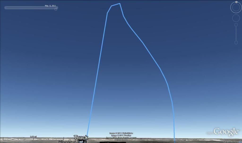
So i’ve downloaded my flight from yesterday, Raven and DC30. I was wrong in listening to the Raven beeps, I thought it was 10K, nope it was 11k woot, 11,045′ to be exact at my first time through the sound barrier at 803 MPH. Rocket was Little Dawg DD, on a J530-Imax. Here is the track from Garmin in Goggle Earth.
Indeed windy up high.
-
AuthorPosts
- You must be logged in to reply to this topic.